


My dad used to live in Phoenix and I’ve been to Arizona many times before, but there’s always more to explore and I found plenty I haven’t seen before while visiting with my friend for his first time.
We landed at Sky Harbor early in the morning, picked up a rental car, and began driving north up I-17. As we drove, we ventured through different landscapes and ecosystems. It was in the 70s and a sunny cactus-filled desert dominated the land in the Valley of the Sun, but the farther north we continued, the cooler and greener it became. When we stopped for lunch, temperatures hovered in the mid 50s but we noticed the wind beginning to pick up. As our road trip continued, blustery gusts tried to force our small Altima from one side of the road to the other and there was a distinct chill in the air outside our car.
Permanent wall-less gazebos used for small open-air markets were mostly abandoned. These people typically benefit economically from the tourism to Red Rocks country, but during the pandemic much of the land has been purposefully closed and tourism shut off.
We left the interstate and the county highway wound into the mountains toward Flagstaff. We passed many small buildings on the side of the road that appeared to be permanent wall-less gazebos, used for small open-air markets; most were abandoned. When we found one that was manned, we made a pit stop to admire the Navajo-made goods on display for sale.
Much of northern Arizona is part of the Navajo Nation. These indigenous people typically benefit economically from the tourism to Red Rocks country, but during the pandemic, the tribe had chosen to keep most of their outdoor lands closed for recreational use in order to keep people safe. My friend made a small purchase from the market we stopped at in an effort to support at least one business owner who must be struggling.
Northern Arizona
Shortly after stopping at the market, we made it to our first destination, Horseshoe Bend. This is an iconic turn in the Colorado River, and it’s an icon of Arizona. But interestingly, the bend is north of the Grand Canyon and not a part of that area at all.
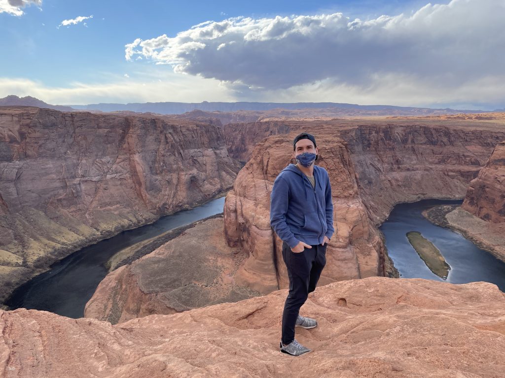
A short trail ran from the parking lot to a look-out. The winds were still blowing fiercely and the trail ran through a sand-filled landscape with loose pebbles blowing against our bodies and faces. We were grateful for our masks, which helped to keep the sand out of our mouths, but we had no such luck keeping it away from our eyes.
Even so, a half mile later, we arrived at the bend and stood in awe at the natural landscape surrounding us. The bright blue water contrasted with the red rocks in a striking juxtaposition. Arizona may not have been as warm as we had hoped, but it was exactly as beautiful as we had envisioned.
We were surprised to arrive at our hotel just a few minutes after leaving Horseshoe Bend. We had expected the drive to be further, but the next town was another 70 miles north, so we decided to stay put as planned. Our Hyatt Place had been built just two years earlier and was one of the nicest such hotels I’ve ever stayed in. The large, new rooms glistened cleanly as we collapsed onto the couch, weary from travel exhaustion.
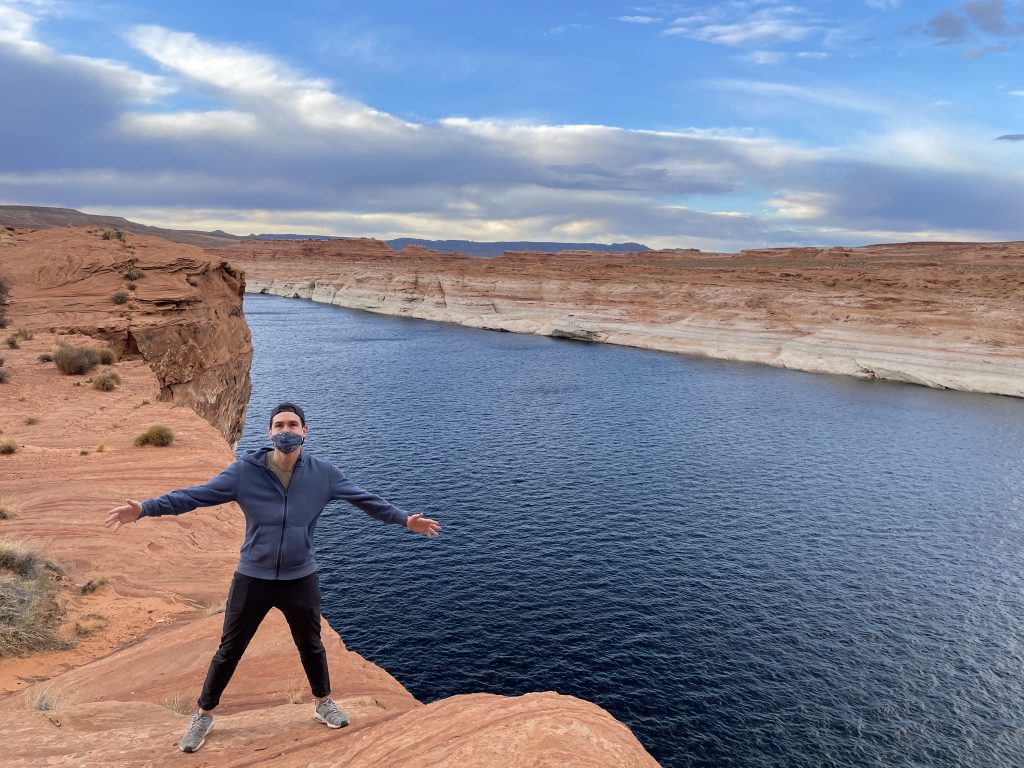
After a brief rest, we set out to explore the red rock structures around Page, AZ. We wandered down a semi-marked trail until we found more spectacular views of the shiny water deep inside the red rock canyons. This trek wasn’t really planned, and the surprise of this view made it that much more rewarding.
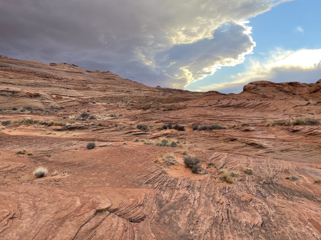
As we walked back to the car, sunset began to cast a red hue on the already-red-tinted sands. We felt as though we were walking across Mars.
Day 2 was poised to be a significant day of hiking. We planned to start a 12 mile trek into a slot canyon following the winding Paria River back to its Colorado River headwaters. We got an early start and began hiking by 9 am. The air was brisk, but less windy today, making it significantly more comfortable than our first sandy walk at Horseshoe Bend. The trek started out easily along a well-marked gravel path. From there, we could look down at the small river and its accompanying late-season ice a few stories beneath us. A few yards farther down the trail, we were inside the canyon, next to the creek. What we had failed to realize was that a trek “along the Paria River” actually meant a trek through the Paria River, with the trail winding back and forth from bank to bank, seemingly oblivious to the aquatic obstacle that stood in its way.
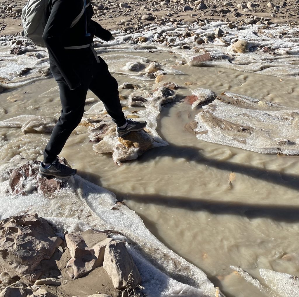
We bounded across the first crossing using ice and rocks to make it to the other side while staying dry, but the second crossing was deeper and wider. We stripped our shoes and socks to wade across the ankle deep water. The ice water of the creek sat at exactly 32 degrees so it was COLD. After several more crossings like this, we decided to turn around, cold and scared that otherwise frostbite would begin to claim our toes. After crossing the banks another half dozen times to make it back to the starting gravel path, we carefully replaced our shoes and socks, then returned to the car, and embarked on Plan B instead.
Our replacement hike picked up roughly where the original would have ended, but it took us over an hour to drive the road from the top of the canyon all the way around and into the bottom of the canyon from the other end. Here, we began hiking into a drier and warmer slot canyon that began descending sharply into itself towards the picturesque river a thousand feet below.
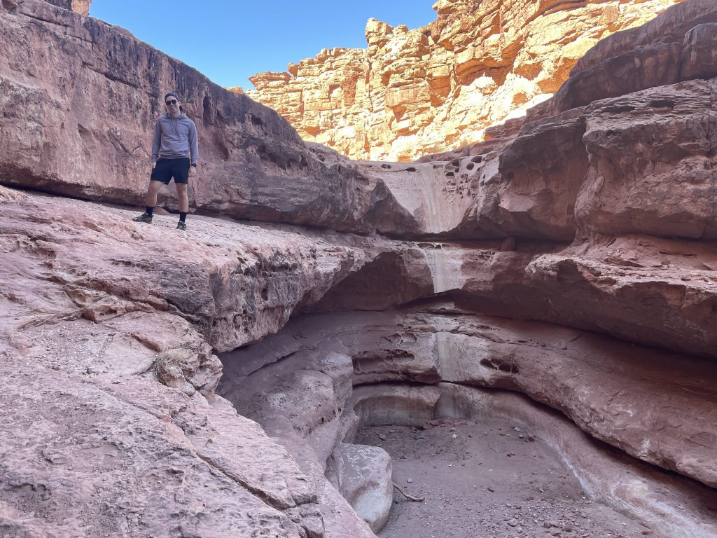
We climbed down deeper and deeper through slot canyons that seemed to grow narrower and close in on themselves. Most of the climbing involved medium to sometimes-large steps, but at one point we had to drop about a foot because we weren’t tall enough to reach from the ledge above. Finally, we heard the sound of rushing water and saw the slot canyons begin to open up into a wide valley featuring a fast-running tributary to the Colorado River. We took a moment to appreciate the scene here.
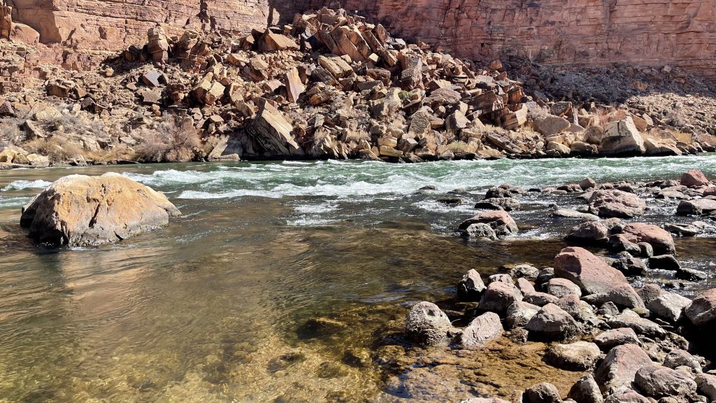
Back in the car a couple hours later, we began to venture towards Sedona, which would be our gateway to Grand Canyon National Park.
The Grand Canyon
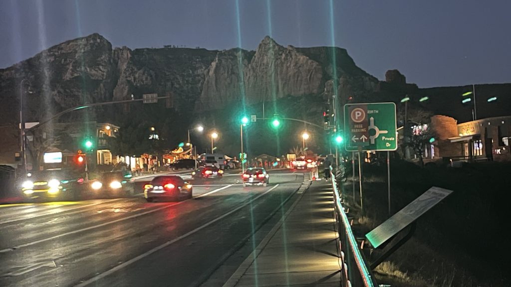
This ride was the most interesting yet. As we left the canyon, Flagstaff’s Humphrey’s Peak beckoned, its peak glistening with snow. Although that wasn’t our destination, we soon found ourselves driving through snow nonetheless. The road was a twisting and curving two lane highway with dozens of switchbacks descending towards the town of Sedona. It was dark now and we took the road slowly and tentatively. As our elevation decreased, the snow eventually disappeared and a warm 60 degree evening welcomed us to town.
We found Sedona to be stunning in its beauty, but less attractive in its culture. We enjoyed the cute neighborhoods filled with stores and restaurants–but also filled with people during the pandemic. Furthermore, although buildings were densely packed into the town, it wasn’t particularly pedestrian friendly or walkable and required driving even short distances. It also felt very homogenous, with even ethnic stores and restaurants being run and staffed entirely by white people. Nonetheless, we enjoyed some excellent empanadas on the patio of our timeshare before calling it a night.
With our goals of a challenging hike stifled on Day 2, we woke up early and headed to the Grand Canyon with the plan of a new challenging hike on Day 3. This time, the challenge delivered. We hiked the Kaibob Trail on the South Rim of the Canyon. The trail technically goes all the way to the Colorado River, in the gorge at the bottom of the Canyon and, I believe, comes up the other side. But this is a long and strenuous multi-day hike. We planned to dayhike only and passed several signs warning us not to attempt making it all the way to the river and back in a single day. We planned to oblige.
The trail began intensely almost immediately. We walked down dozens of switchbacks, dropping a thousand feet in elevation in the first mile. We were descending into the canyon, and the views were also immediately breathtaking.
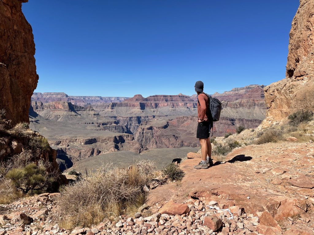
About a mile and a half into the trail, we passed a small bathroom outhouse. At this point, the trail became significantly more difficult as the switchbacks morphed into steep stairs. It may not sound challenging to walk down stairs, but the sheer number of them–in total, the trail’s elevation change is roughly equal to the height of three One World Trade Center towers–made the hike extreme. It was difficult on my knees and I felt wobbly and unstable by the time we reached the bottom.
Speaking of the bottom, I found it to be a bit underwhelming. After being spoiled for the views over the last two hours of descending, here all we could see was what appeared to be a field. We rested briefly and then turned around; there was no need to delay the inevitable for this view, after all.
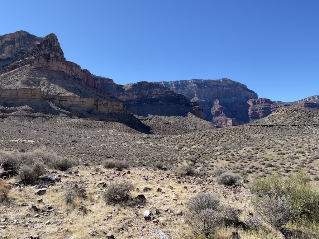
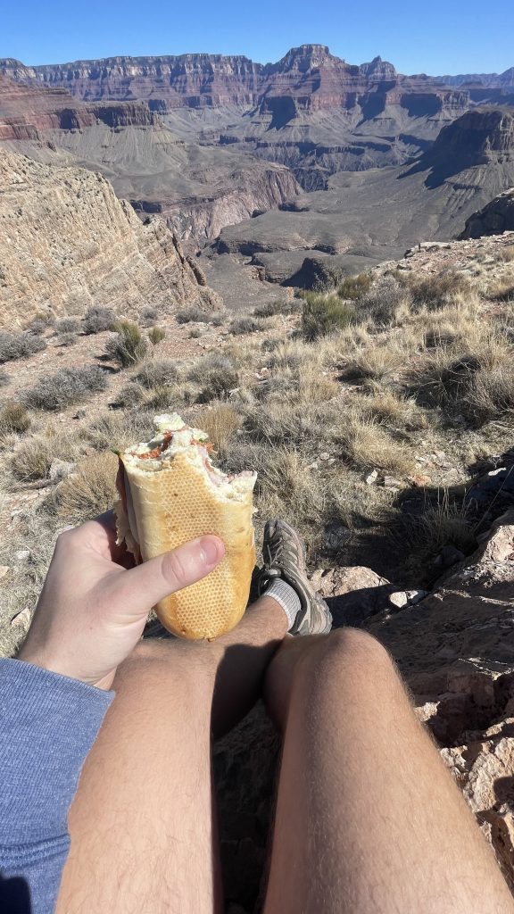
On the way back up, we stopped roughly every half mile. It was steep, it was exhausting. On one of our first stops, we enjoyed our packed lunch from Safeway. Under normal conditions, we would have found our sandwiches disgusting–too much bread, too little meat, and no flavor whatsoever. But we were ravenous and–heck!–we had an amazing view to enjoy instead of the flavor.
It is truly impossible to exaggerate the difficulty of this hike. Its relentless stairs continued for 3.5 miles and 3500 feet–that’s 1000 feet up for every mile. But with frequent breaks and a bit of encouragement, we were eventually able to emerge from the canyon and make it back to our waiting Altima.
After this grueling six hour hike, a private hot tub to end the day was exactly what the doctor ordered. I could barely move my body out of bed the next day, so we did a short and easy hike to try and loosen up before heading back to the airport. At this point, relaxing with a glass of champagne in my SkyClub happy place was the best treat I could have asked for. It was another successful trip, and as an added bonus I had closed my Apple Watch workout rings three times over during the Grand Canyon hike…a record that won’t soon be repeated, I hope!
